
Town & City Historic Maps
Bradford
Wool Capital of the World


Bradford has a long history as a clothmaking centre, but at the end of the 18th century it was still a market town of fewer than 7000 people. The Industrial Revolution transformed the shape of the town, as the wool spinning and cloth-weaving that had been cottage industries moved to large factories. By the time of the census of 1841, Bradford’s population had grown to more than 35,000, and it was on its way to becoming the ‘wool capital of the world’; by 1851 its population was more than 150,000. It was also a coal-mining town, and a centre of iron founding. The legacy of the development of this famous industrial town is a wide range of fine buildings, many of which survive today.
Bradford’s rapid growth created extremes of wealth and poverty but also spurred important innovations in public welfare and new civic institutions which are evident in the imposing nineteenth century redevelopment of the city centre. All of this makes the map a fascinating and unique insight both into Bradford’s past and into that of Britain’s Industrial Revolution as a whole.
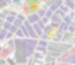
Taking as its base a 1921 Ordnance Survey map of the town, the Historical Map of Bradford covers the three conservation areas of Bradford city centre, Manningham and Little Germany. On a multi-period map it shows how Bradford grew rapidly from a modest medieval village and small market town into a leading manufacturing centre during the Industrial Revolution. The map includes lost buildings, industrial sites, cemeteries, earthworks and sites of interest as well as those that remain. A comprehensive gazetteer on the map’s reverse, complete with many illustrations and subsidiary maps, explains the complex development of the city.
The researcher and author behind the map is Yorkshire-based archaeologist, Ian Roberts. The Historic Towns Trust is incredibly grateful for all his work on the project.


