
The Secrets of Coventry’s Buried Water System
- Mar 21
- 3 min read
By Sydney Burgess
Upon closer look of the Historic Towns Trust map of Coventry, delicate blue lines emerge among street and property boundaries (Figure 1). These faint traces of the River Sherbourne once powered Coventry’s industry, defined its neighbourhoods and structured daily lives.

This river, which has its source at Corley Moor, moves underground once it reaches Coventry into a large culvert. It briefly emerges at Palmer Lane before vanishing again and leaves the culvert by Gosford Street and Gulson Road. As traced on the map, it passes through Charterhouse grounds and then flows onwards through Whitley Abbey Bridge before joining the River Sowe.
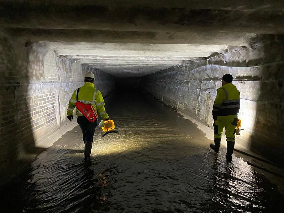
Despite efforts to uncover the River Sherbourne, today, much of this system remains underground in the city centre (Figure 2). Instead, it survives most clearly in our layered historical map, which is able to give a multi-period view of the city, showing lost or buried features alongside those that remain.
Having once flowed openly through the city, the River Sherbourne and its tributaries fed a network of mills that supported Coventry’s medieval economy. Whilst only 9 miles long, there were 13 watermills along the Sherbourne at the peak of the medieval period. Both watermills and malt mills were fundamental to the everyday lives of medieval people, with cloth and textile production being central to the medieval cities’ prosperity. These depended on a reliable water supply. Medieval mills can be identified by following the waterways on the map and looking for the label ‘mill’ accompanied by a red dash box filled with yellow lines.
The aptly named Mill Pond and Dam, for example, indicates a location where water was deliberately impounded and controlled to power the industry. Following the river’s course across the map also reveals Earl’s Mill (Figure 3), Crow Mill (Figure 4), unnamed shut mills (Figure 5), and the Charterhouse mill (Figure 6). Many of these had already disappeared by the early twentieth century, but the map indicates that they once stood strategically placed along the river.


From the nineteenth century onwards, however, this visible water system began to disappear. This was largely due to Coventry’s population growth, particularly during the Victorian period and again after the Second World War. At the same time, Coventry’s industrial capacity expanded rapidly. First, with the change from water power to steam power to combustion engines, and then with the industry boom of the Second World War. Together, these changes meant that the water system had to keep up. As a result, the streams were redirected underneath the ground. Today, roads, carparks and buildings now follow the paths of streams that flow beneath as the river was gradually culverted, built over and absorbed.
This transformation can be directly traced on the map. As the blue lines are followed into the city centre, they appear to cross into the city’s streets and buildings. In places, fainter blue lines can be seen too. These verge off from the main river, marking former channels that have since been rerouted or lost.
Efforts to manage Coventry’s water system continued into the modern period.
Modern infrastructure projects, such as large-scale pipe replacement programmes, reflect the ongoing challenge of managing a historic water system within a contemporary urban environment. For instance, Severn Trent Water is currently undertaking a £76 million Green Recovery program in Coventry to replace old, lead or shared underground supply pipes with plastic pipes.
Therefore, historical maps like this one allow us to see the hidden past, in which comparison with the present-day street plan only reveals subtle clues like unexpected curves in road layouts and dips in terrain. Tracing these lines across the map allows the river’s course to be followed through the city in a non-invasive and illuminating way. This allows us to look beneath Coventry’s concrete surface and understand why the city looks the way that it does today.


